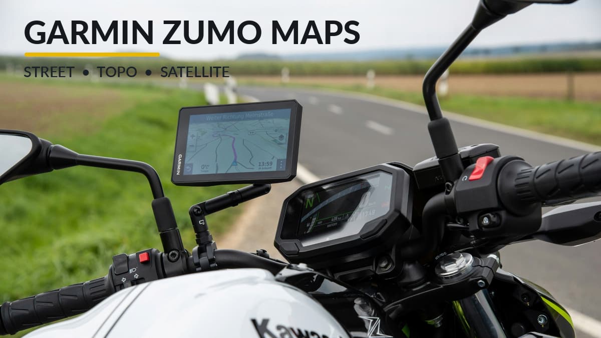
Garmin Zumo maps provide more than conventional highway navigation. Modern motorcycle GPS models include street maps, topographic information, and downloadable satellite imagery. Some also support additional mapping layers for adventure riding. Understanding the differences helps you choose the right map for paved roads, gravel routes, and off-road exploration without purchasing unnecessary map products.
Quick Answer: Most Garmin Zumo owners do not need additional maps for ordinary motorcycle touring. Modern models include City Navigator street maps and TopoActive mapping for terrain information. The XT and XT2 also support BirdsEye Direct satellite imagery, while the XT3 introduces additional map layers and optional Outdoor Maps+ features. The right combination depends on whether you ride paved highways, gravel roads, or off-road trails.
What Maps Come with a Garmin Zumo?
Garmin has expanded the mapping capabilities of its motorcycle GPS devices considerably. Older Zumo models concentrated on street navigation, while the XT family adds terrain information, satellite imagery, and features intended for riders who travel beyond ordinary highways.
For North American models, the Garmin Zumo XT, XT2, and XT3 include City Navigator street maps and versions of Garmin’s TopoActive PowerSports mapping.
The important distinction is that these maps serve different purposes. Street maps provide turn-by-turn road navigation. Topographic maps show additional geographic information. Satellite imagery supplies a photographic view of the surrounding landscape.
| Mapping Feature | Zumo XT | Zumo XT2 | Zumo XT3 |
|---|---|---|---|
| City Navigator street maps | Included | Included | Included |
| TopoActive mapping | PowerSports | PowerSports Lite | PowerSports Lite |
| Satellite imagery | BirdsEye Direct | BirdsEye Direct | Satellite Imagery |
| Third-party IMG maps | Supported | Supported | Supported |
| Outdoor Maps+ | Not supported | Not supported | Optional subscription |
These details apply to North American Zumo models. Included mapping and regional coverage can differ elsewhere.
Most road riders can rely on the maps included with their GPS. Additional mapping becomes more interesting when planning international trips, exploring unfamiliar backcountry terrain, or following specialized off-road trails.
City Navigator: Garmin Street Maps
City Navigator is Garmin’s primary mapping product for conventional road navigation. It contains the road information used for calculating routes and delivering turn-by-turn directions on compatible devices.
City Navigator supports familiar GPS functions including:
- Highway and local-road navigation
- Address searches and points of interest
- Turn-by-turn directions
- Automatic route calculation and recalculation
- Navigation to fuel stops, lodging, restaurants, and other destinations
Modern North American Zumo models include detailed street maps. Most owners therefore do not need to purchase City Navigator separately for riding within the included geographic coverage.
The Zumo’s additional navigation features work with the underlying map information. Garmin Adventurous Routing, for example, can favor more interesting roads rather than simply selecting the fastest route.
City Navigator vs. Google Maps
Garmin City Navigator and Google Maps can both provide road navigation, but they use different approaches.
A Garmin Zumo stores its navigation maps locally. Once the appropriate maps are installed, the GPS can calculate routes and provide directions without cellular service.
Google Maps can also function offline when suitable map areas have been downloaded. However, some features require an internet connection.
For motorcycle touring, the Zumo combines locally stored maps with dedicated navigation hardware, motorcycle-focused routing features, and a display designed for outdoor use.
International Street Maps
Traveling outside the region covered by your GPS may require additional map data. A North American Zumo does not necessarily include the street maps needed for a motorcycle trip through Europe or other regions.
Garmin offers geographic mapping products for compatible devices, but availability and installation requirements vary.
Check the specific map product and its compatibility list before purchasing. An older City Navigator microSD card advertised for a Garmin Nuvi or handheld GPS should not automatically be considered compatible with a modern Zumo.
Garmin TopoActive Maps for Off-Road Riding
Garmin TopoActive maps display geographic information that conventional street maps may not emphasize. Depending on the product and region, this includes waterways, natural features, public land boundaries, and unpaved roads.
The original Zumo XT includes TopoActive PowerSports mapping. The XT2 and XT3 use TopoActive PowerSports Lite.
These maps are adapted for Garmin’s motorcycle navigation displays. Their color schemes emphasize dirt roads and other information useful to riders exploring beyond paved highways.
For adventure riders, the additional geographic detail can help identify surrounding terrain, understand the relationship between roads and natural features, and examine unfamiliar areas before a ride.
Important: Garmin confirms that its preloaded TopoActive PowerSports maps are not used for routing. A trail appearing on the topographic map does not mean your Zumo can calculate turn-by-turn directions along it. Specialized trail-routing features require compatible routing data and supported navigation functions.
TopoActive vs. City Navigator
City Navigator handles conventional road navigation. TopoActive adds geographic and terrain information to the map display.
If you enter a hotel address and ask the GPS to calculate a route, City Navigator provides the underlying road information.
If you want to examine the surrounding terrain, waterways, or boundaries of a national forest, TopoActive provides additional context.
These products complement one another, but they are not interchangeable.
Do You Still Need Garmin TOPO 24K Maps?
Older Garmin mapping products included regional TOPO 24K and TOPO 100K maps. These numbers refer to map scale. A 1:24,000 map generally provides greater geographic detail than a 1:100,000 map.
Those products may still be relevant to certain older Garmin devices and specialized applications. However, modern Zumo owners already have topographic information installed in North American models.
Purchasing a separate TOPO map solely to display terrain may be unnecessary. If a specialized mapping product offers additional information you need, confirm that Garmin specifically lists your GPS as compatible.
Original Zumo XT TopoActive Updates Have Ended
There is an important limitation for owners of the original Zumo XT.
Garmin discontinued updates for the TopoActive PowerSports maps supplied with that model. Version 2022.20 was the final release.
This does not mean that every map or software update for the original XT has ended. The discontinued product is specifically the TopoActive PowerSports mapping component.
City Navigator street maps and device software have separate update availability.
Garmin explains this distinction in its TopoActive PowerSports support documentation.
Satellite Imagery: BirdsEye and Zumo XT3 Maps
Satellite imagery provides a photographic view of the landscape rather than a conventional drawn map. It can help riders examine unfamiliar terrain, forest roads, clearings, water crossings, and other geographic features.
The original Zumo XT and XT2 support BirdsEye Direct Satellite Imagery. Garmin provides downloadable imagery on these models without an annual BirdsEye subscription.
The XT3 uses a newer map interface with a Satellite Imagery map type. It supports downloaded imagery and can combine certain map types using hybrid map views.
Garmin also offers additional premium map content through Outdoor Maps+ on the XT3. The subscription service is separate from the basic satellite imagery functions, and available coverage depends on the selected content.
When Is Satellite Imagery Useful?
Satellite imagery is especially helpful during route planning. A conventional map may show a road without revealing much about the surrounding terrain. Satellite photographs can offer clues about whether the area is wooded, developed, mountainous, or largely open.
However, a satellite photograph cannot establish whether a road is legally open to motorcycles, maintained, or currently passable. Images may also be older than the most recent road changes.
For most riders, the best approach is to use conventional street maps for active navigation and satellite imagery as an additional planning reference.
Download the imagery covering your intended riding area before leaving reliable Wi-Fi service. Previously downloaded areas can be viewed offline.
Garmin Outdoor Maps+ on the Zumo XT3
Outdoor Maps+ is Garmin’s optional subscription service for additional outdoor mapping content. Among the XT, XT2, and XT3 motorcycle navigators, the XT3 is the model supporting this service.
The subscription provides access to premium map layers, with coverage and available features varying by location.
One particularly interesting capability for adventure riders is Garmin’s Adventure Roads & Trails mapping.
The XT3 includes map-layer controls for displaying available adventure roads and trails. Garmin’s premium Adventure Roads & Trails capabilities, available with the applicable Outdoor Maps+ content, can extend this with supported off-road trail navigation and turn-by-turn routing.
That is an important difference from the preloaded TopoActive PowerSports Lite map, which supplies reference information rather than functioning as a routable trail map.
On compatible XT3 maps, Garmin also provides information related to trail access, difficulty, and vehicle parameters.
Is Outdoor Maps+ Worth Buying?
For riders who primarily use highways, scenic paved roads, and occasional gravel roads, the preloaded maps will often be sufficient.
Outdoor Maps+ becomes more appealing when planning frequent trips into remote areas where additional trail information, geographic overlays, or premium off-road navigation features can be useful.
Before subscribing, examine the available layers and coverage for the regions where you expect to ride.
Garmin explains the available features and subscription requirements in its Zumo XT3 map layers guide and Outdoor Maps+ installation instructions.
Can You Install OpenStreetMap and Other Third-Party Maps?
Yes. Garmin confirms that the Zumo XT, XT2, and XT3 support compatible third-party maps supplied in Garmin IMG format.
These maps may be based on OpenStreetMap data or designed for particular outdoor activities and geographic regions.
OpenStreetMap is a collaborative geographic database used by numerous mapping projects. Some map providers package that information for Garmin GPS devices, although the detail and routing capabilities depend on the particular map.
Third-party maps may be worth considering when Garmin’s standard mapping does not provide the regional information you need.
Installing Third-Party Garmin IMG Maps
Garmin documents the following installation process for compatible IMG files using a Windows computer:
- Download a Garmin-compatible IMG map from a reputable provider.
- Check the map’s compatibility with your Zumo model.
- Insert a compatible microSD card into the GPS.
- Connect the GPS to a Windows computer using a suitable USB cable.
- Open the device’s microSD storage in File Explorer.
- Create a folder named Map if one is not already present.
- Copy the IMG file into that folder.
- Safely disconnect the GPS.
- Open the device’s map settings and enable the new map if necessary.
Garmin also supports placing compatible IMG files in the appropriate Map folder within the device’s internal storage. A removable microSD card can be more convenient for managing optional maps.
Some third-party maps overlap existing Garmin mapping. If a newly installed map does not display correctly, you may need to disable another map covering the same area. Garmin recommends keeping the basemap enabled.
Remember that Garmin does not guarantee compatibility with third-party maps or provide support for every outside mapping product. Download files from reputable sources and avoid modifying or deleting factory-installed map files.
See Garmin’s official third-party IMG map installation instructions for additional details.
Our Garmin Zumo microSD card guide explains memory card considerations for motorcycle GPS devices.
Garmin Maps vs. GPX Routes and Tracks
A map and a GPX file perform different functions, although motorcycle riders frequently use them together.
A map provides geographic information such as roads, terrain, and landmarks. A GPX file stores geographic data such as waypoints, planned routes, and recorded tracks.
For example, you might download a GPX track for a scenic motorcycle ride through a national forest. The GPX track identifies the intended path, but it does not necessarily supply the underlying road or terrain map.
Likewise, importing a GPX route does not guarantee that every Zumo model will calculate identical turn-by-turn directions. Routing settings and the installed routable map can influence the result.
A GPX track can be especially helpful when following an unpaved route that conventional street navigation does not recognize.
Before riding in an unfamiliar area, verify that your maps provide adequate coverage and that the imported GPX information displays as expected.
For step-by-step guidance, see our Garmin Zumo GPX import guide for the XT, XT2, and XT3.
How to Update Garmin Zumo Maps
Roads, intersections, addresses, and other geographic information change over time. Keeping your installed street maps current can improve routing accuracy, particularly in areas where roads have recently been added or modified.
Modern Garmin Zumo devices support map and software updates through Wi-Fi or Garmin Express.
Updating Maps Over Wi-Fi
On the Garmin Zumo XT3, the update process is:
- Connect the GPS to a reliable Wi-Fi network.
- Open Settings > Updates.
- Allow the device to check for available updates.
- Select the available map or software updates.
- Accept the applicable license agreements.
- Connect external power and complete the installation.
The exact menu arrangement may differ on the XT and XT2, so follow the instructions for your particular model.
Map downloads can be large. Avoid interrupting an update, and keep the GPS connected to suitable external power until installation finishes.
Updating with Garmin Express
Garmin Express is the company’s desktop application for managing compatible GPS devices and installing available updates.
- Install Garmin Express on a supported Windows or Mac computer.
- Connect the Zumo using the appropriate USB cable.
- Open Garmin Express and add the device if necessary.
- Review available map and software updates.
- Install the updates and follow the displayed instructions.
Garmin Express is available through Garmin’s official download page.
Do Garmin Zumo Maps Have Lifetime Updates?
Some Garmin devices have been sold with lifetime map update eligibility for included street maps.
Lifetime eligibility does not mean every map product or GPS feature will continue receiving updates indefinitely. Garmin’s map support terms and product availability determine which updates remain eligible.
The discontinued TopoActive PowerSports mapping on the original Zumo XT demonstrates why different map products should be considered separately.
If a map update requires more storage than your GPS currently has available, Garmin Express may recommend installing a compatible microSD card.
Memory card formatting requirements vary. In particular, Garmin specifies exFAT for Zumo XT3 memory cards. Do not assume that older Zumo instructions requiring FAT32 apply to the XT3.
Which Garmin Maps Should Motorcycle Riders Use?
Different riding styles call for different mapping information. Here are our recommendations for common motorcycle navigation situations.
Highway and Touring Riders
City Navigator is generally sufficient for normal touring. It provides the road network, points of interest, and turn-by-turn navigation needed for highways and local roads.
Keep the street maps updated and use the Zumo’s route-planning tools to customize your ride.
Scenic Road and Weekend Riders
City Navigator remains the primary map. Garmin Adventurous Routing and other supported motorcycle navigation features can help identify more interesting paved roads.
Topographic information may provide additional geographic context, but specialized terrain maps are not essential for conventional weekend rides.
Adventure and Gravel Riders
City Navigator, TopoActive, and satellite imagery make a useful combination.
Street maps provide conventional navigation on supported roads. Topographic information helps identify surrounding terrain, and satellite photographs provide another reference when examining unfamiliar areas.
GPX tracks can be helpful for following planned unpaved routes.
Always check current access restrictions and road conditions. A road or trail appearing on a map does not guarantee that motorcycles are permitted.
Dedicated Off-Road Riders
Riders who regularly explore trail networks should pay particular attention to the XT3’s Outdoor Maps+ capabilities and Garmin’s dedicated Tread navigation products.
Specialized trail data, supported off-road routing, and vehicle-specific access information can be more important than simply displaying additional topographic details.
Do You Need to Buy Additional Garmin Maps?
For most motorcycle owners using a recent North American Zumo, the included maps cover everyday road navigation and provide useful geographic information for occasional adventure riding.
Additional maps become worth considering when traveling outside the included coverage area, following specialized off-road routes, or seeking more detailed local information than the standard maps provide.
Before buying an additional mapping product, check its compatibility, geographic coverage, routing capabilities, and whether similar information is already installed.
Considering a Newer Garmin Zumo?
The Garmin Zumo XT3 includes modern street and topographic mapping, downloadable satellite imagery, and optional Outdoor Maps+ capabilities. Its expanded mapping environment may appeal to riders who want more outdoor navigation features.
Frequently Asked Questions
Can a Garmin Zumo Work Without Cell Service?
Yes. A Garmin Zumo can use installed maps and GPS satellite positioning for navigation without cellular coverage. Some connected services, map downloads, and smartphone-dependent features require an internet connection.
Are Garmin TopoActive Maps Routable?
The TopoActive PowerSports maps preloaded on the Zumo XT family are not used for routing. Specialized off-road navigation requires compatible routing data and supported device features.
Can I Download Free Garmin Zumo Maps?
Eligible preloaded street maps can receive updates according to Garmin’s support terms. The XT and XT2 also offer BirdsEye Direct satellite imagery downloads without an annual subscription. Some third-party Garmin-compatible maps are available without charge, while premium products and Outdoor Maps+ content may require payment.
Can I Add More Maps with a microSD Card?
Yes, provided the maps are compatible with your Zumo. A microSD card increases available storage, but it does not contain geographic information unless compatible maps have been installed on it.
Can a Garmin Handheld GPS Be Used on a Motorcycle?
Some Garmin handheld devices can be adapted for motorcycle navigation, but their maps, routing capabilities, display sizes, mounting options, and power connections vary. Our handheld GPS motorcycle guide explains the main considerations.
Final Thoughts
Modern Garmin Zumo devices include more mapping information than many motorcycle riders will ever need. City Navigator handles ordinary road navigation, TopoActive adds geographic detail, and satellite imagery provides a photographic view of unfamiliar areas.
The XT3 expands those capabilities with additional map layers and optional Outdoor Maps+ features, making it especially interesting for riders who frequently explore beyond paved highways.
Start with the mapping already installed on your GPS. Identify any gaps in coverage or navigation capability, then add specialized maps only when they provide information useful for your riding.
For help positioning and securing your GPS, see our motorcycle GPS mounting and installation guide.